
For those with time and enthusiasm, or those with a love for walking, Duhallow is best explored on foot and will reveal a breathtaking variety of scenery. Whether it’s trekking along the Mullaghareirk Mountains or along Mount Hilary or going for a stroll in the Island Woods, the Duhallow region has a variety of walks to suit all ages and interests.
The Duhallow Way
The Duhallow Way, makes up the first part of the Blackwater Way – a 168km (104 miles) linear long distance walking route that stretches from the boarders of County Kerry, across North Cork and into County Waterford, starting in Clydagh and crossing the Derrynasaggart mountain range and following parallel to the River Blackwater.
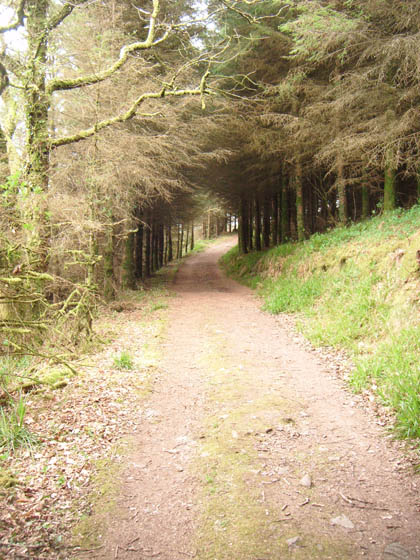
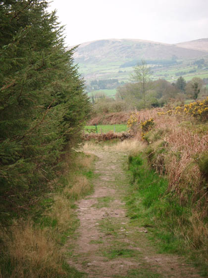
The Duhallow Way is a richly varied one in terms of topography and includes contouring sections along mountain flanks with great views, contrasting with views of wild bog, forest roadways, glens, lakes, rivers and stretches of beautiful isolation. The unspoilt landscapes are abounding in plant and animal life, displaying all nature’s colours – emerald green, golden yellow, purple and brown. The Way is an area of rugged beauty, a place which one could explore for days on end, features along the way include passing by ancient monuments such as standing stones, stone circles and cairns, and more modern monuments such as cillins (infant burial grounds) and holy wells. There are no significant ascents apart from the climb of 560m meters under Caherbarnagh and the Paps.
Grade: Strenuous – suitable for people accustomed to walking rough trails with a high level of fitness. Typically all day or multiday walkers. Specific outdoor walking footwear and clothing required.
Trail Users: Pedestrian trail – strictly no cyclists or equestrian use.
Distance: 67km (42 miles) linear walk.
Time: Full trail takes 2 -3 days depending on levels of fitness.
Total Ascent: 1,740 meters (maximum elevation: 498 meters).
Waymarking: The yellow walking man with a yellow arrow that you can see at the top of this page is used to waymark the Duhallow Way. This waymarker on posts, telegraph poles and trees along the trail to reassure you that you’re on the right path!
For more information or to report any trail maintenance issues please contact the Rural Recreation Officer at IRD Duhallow Colm O’Connor on 029-60633 or out of office hours on 086 0849 955.
Dogs: ***Following complaints from concerned landowners due to sheep-worrying causing injury/death, strictly NO DOGS PERMITTED on Mushera/Maulnahorna Mountain and in the Shrone/Slyguddal area.
IN ORDER TO KEEP THE HILLS OPEN TO WALKERS, IT IS IMPERATIVE TO RESPECT THE LANDOWNERS AND STOCK***
Maps: OSI Sheet numbers 79 & 80. IRD Duhallow recommend using the maps below as OSI maps may have older versions of the Duhallow Way marked, any diversions/route changes are uploaded onto the maps below:
Services along the trail: Starting/finishing in Clonkeen the nearest services are available in Ballyvourney. Starting/finishing in Bweeng the nearest services are available in Mallow. Millstreet is the halfway point of the trail, accommodation, public transport and services are available here.
Parking: If you are planning on doing the Duhallow Way from start to finish logistically the easiest option is to get dropped at one end and collected at the other. However, there are various points along the way where one can park and walk a short distance to join the Duhallow Way. In each of these locations please leave enough space for a tractor/large vehicle to pass and ensure that you do not block the road or any gates/entrances.
Clonkeen: Outside the Church where the trail starts.
Shrone Church: Parking outside the Church starting point with car space.
Millstreet: Public car park available opposite St. Patricks Church.
Bweeng: Pull in on the side of the road, ensure you are not blocking local access.
Shrone: Google maps pin: parking at Shrone, enough space for 3-4 cars here. At the end of the road you come to a gate, park on the far side of the gate, and please close behind you. Don’t block the road as farmers and local landowners use it for access. From here walk towards Shrone Lake and you will meet the Duhallow Way.
Poetry along the trail: Along the Duhallow Way you will find signs with fragments of Irish bardic poetry about specific places along the walk. This page is for those who are curious to experience the full poems in Irish and their English translations.
The Duhallow region has a variety of walks to suit all ages and interests


Boherbue Looped Walk
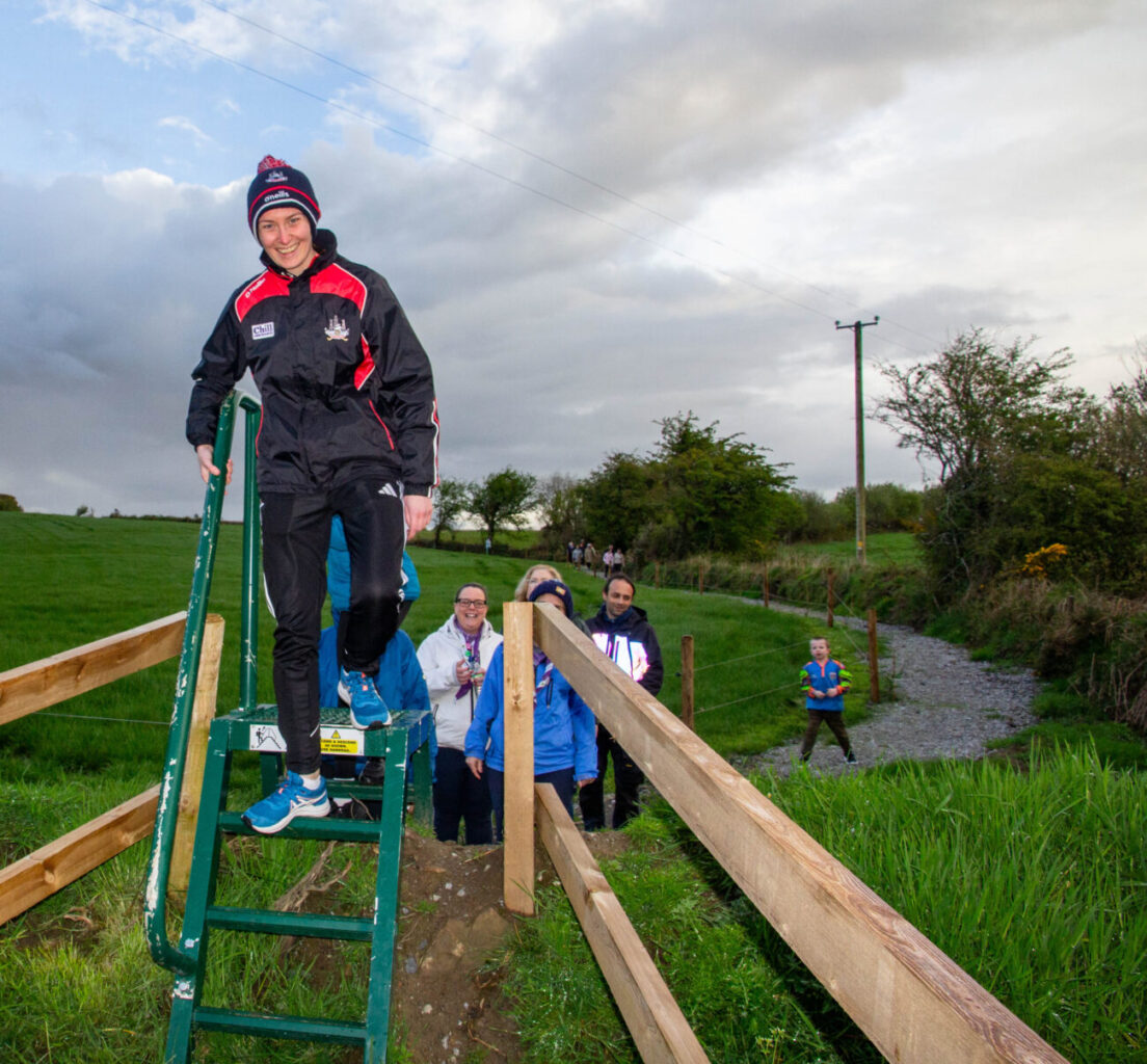
In April 2025, we officially opened the Boherbue walk, it follows the tail of an old mass path and then joins a local road that loops back into the village of Boherbue. The trail head is in the centre of the village where the walk and its information is illustrated on a map.
The trail has a mix of gravel paths along with tarmac roads and the village footpaths, so all types of footwear are suitable, It is graded as Moderate difficulty because of steps and a stile going over a ditch and stream, but we are confident that most people of moderate fitness would manage to walk it. People with mobility issue may find this hard and is not suited for them.
Trailhead & Parking: Parking is available at the Trailhead at the village and shops are close by.
Contact: Colm O’Connor 029-60633 or out office hours 086-0849 955

Kiskeam Looped Walks
There are five different looped walks in Kiskeam. Each trail in Kiskeam is signed by different coloured arrows defining each trail separately along each trail. One of these trails will suit most levels of fitness and mobility. The under-foot trail is a gravel surface which will suit all footwear, runners or shoes. For anyone with mobility issues we would suggest using the Ballydesmond road car park as it is level with the walk. These trails are completely off road and are plenty wide enough for Buggies. There is also seating along the trails if peoplewant to take a break or just sit and enjoy the nature of the area.
It is also suggested that the Kiskeam walk will be an ideal home for a Running or Walking club where you could combine the loops to increase distance or difficulty on this all-gravel trails.
Trailhead & Parking: Trailhead Can be accessed from car parks on either the Doon or Ballydesmond roads.
Contact: Colm O’Connor 029-60633 or out office hours 086-0849 955


Mount Hillary
Mount Hillary is located South East of Banteer village and consists of three different looped walks which are listed below.
For more information on this walk please download the brochure. Please note the track to the steps is not as far west as noted on the maps, this does not alter the distances.
The trail has been clearly marked with directional arrows and you should note that the trail is marked in one direction only for each of the trails.
Brochure/Maps: Walking Duhallow – Mount Hillary
Knightfield Loop – Green Loop |
|
| Start/Finish: | Trailhead at car park. |
| Distance: | 4km/2.5 miles |
| Grade: | Easy – suitable for family groups including children. Normal outdoor footwear can be worn. |
| High Point/Ascent: | 220m/130m |
| Time/Duration: | 45 minutes – 1 hour |
| Dogs: | Dogs permitted, please clean up after them. |
Father Murphy’s Loop – Blue Loop |
|
| Start/Finish: | Trailhead at car park. |
| Distance: | 7km/ 4.3 miles |
| Grade: | Easy – suitable for family groups including children. Normal outdoor footwear can be worn. |
| High Point/Ascent: | 300m/240m |
| Time/Duration: | 1.5 – 2 hours |
| Dogs: | Dogs permitted, please clean up after them. |
Mount Hillary Loop – Red Loop |
|
| Start/Finish: | Trailhead at car park. |
| Distance: | 10km/ 6.2 miles |
| Grade: | Moderate – appropriate for people with a moderate level of fitness and some walking experience. Specific outdoor walking footwear and clothing is recommended. |
| High Point/Ascent: | 390m/340m |
| Time/Duration: | 3 -3.5 hours |
| Dogs: | Dogs permitted, please clean up after them. |

Trailhead & Parking: Mount Hillary Parking.
Services: Closest town to Mount Hillary is Banteer (6km/3.7 miles away), public transport available here. Closest town with services is Kanturk (11km/6.8 miles away), shops and restaurants available here.
Contact: Colm O’Connor 029-60633 or out office hours 086-0849 955
The Island Wood
The Island Wood, located 3.2km/2 miles outside of the town of Newmarket, is a beautiful wooded landscape area which is perfect for a walk, run or a picnic.
For more information on this walk please download the brochure
Brochure/ Map: Walking Duhallow – Island Wood
| Start/Finish: | Trailhead at car park |
| Distance: | Section A (green on map): 1.5km/ .6 miles Section B (purple on map): 2.5km/ 1.5 miles Section C (red on map): 7.4km/ 4.6 miles |
| Grade: | Easy – suitable for family groups including children. Normal outdoor footwear can be worn. |
| Duration: | 1 – 1.5 hours |
| Dogs: | Dogs permitted, please clean up after them. |
Trailhead & Parking: Island Wood parking.
Services: Closest town is Newmarket (3.5km/2.2 miles away), all services available here.
Contact: Colm O’Connor 029-60633 or out office hours 086-0849 955
Claragh Loop
The Claragh Loop’s starting point is located in Millstreet in Co. Cork. For more information on this walk please download the brochure.
The trail has been clearly marked with directional arrows and
you should note that the trail is marked in one direction only.
Brochure/Map: Walking Duhallow – Clara Loop
| Start/Finish: | Trailhead at public car park. |
| Distance: | 10km/ 6.2 miles |
| Grade: | Strenuous – suitable for people accustomed to walking rough trails with a high level of fitness. Typically all day or multiday walkers. Specific outdoor walking footwear and clothing required. |
| High Point/Ascent: | 390m/340m |
| Time/Duration: | 2.5 – 3 hours |
| Dogs: | Dogs permitted, please clean up after them. |
Trailhead & Parking: Public car park available opposite St. Patricks Church.
Services: All services available in Millstreet.
Contact: Colm O’Connor 029-60633 or out office hours 086-0849 955
Mullaghareirk Mountains
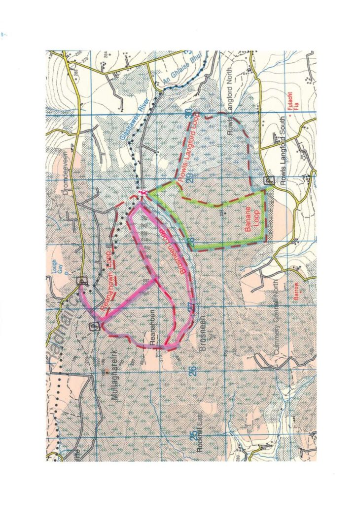
Mullaghareirk Mountains are located north of Meelin in Co. Cork. The loops are arranged in pairs- the green and blue circle Banane Hill and the red and purple take the walker onto the shoulder of Mullaghareirk. This walk is signposted from Meelin village.
Parking for trailheads: For Banane (Green) & Rowls Langford (Blue) Loops you can park here. For Reanahoun (purple) and Brosneen (Red) Loops you can park here at the main road, on walks with IRD we normally start from here. In each of these locations please leave enough space for a tractor/large vehicle to pass and ensure that you do not block the road or any gates/entrances.
For more information on this walk please download the brochure here. Walking Duhallow – Mullaghareirk Mountains.
Up-to-date map with routes highlighted in respective colours available below:
Walk A: Green- Banane Loop |
|
| Theme: | Nature |
| Terrain: | Forestry Tracks |
| Distance/Difficulty: | 5.6km/ Easy |
| Ascent: | 103m |
| Duration: | 1-1.5 hours |
| Minimum Gear: | trekking shoes, rain gear |
Walk B: Blue- Rowls Langford Loop |
|
| Theme: | Nature |
| Terrain: | Forestry Tracks |
| Distance/Difficulty: | 7.3km/ Easy |
| Ascent: | 123m |
| Duration: | 1.5 – 2 hours |
| Minimum Gear: | trekking shoes, rain gear, fluids |
Walk C: Red- Brosneen Loop |
|
| Theme: | Nature |
| Terrain: | Forestry Tracks |
| Distance/Difficulty: | 10.3km from main road, 7.7km from steeple/ easy |
| Ascent: | 169m from main road,113m from steeple |
| Duration: | 2.5-2.75 hours from main road,1.5-2 hours from steeple |
| Minimum Gear: | trekking shoes, rain gear |
Walk D: Purple- Reanahoun Loop |
|
| Theme: | Nature |
| Terrain: | Forestry Tracks |
| Distance/Difficulty: | 8.2km from parking at main road, 6.57km from parking at steeple/ Moderate |
| Ascent: | 151m from parking at main road, 138m from parking at steeple |
| Duration: | 1.5-2 hours from main road, 2-2.25 hours from steeple |
| Minimum Gear: | trekking shoes, rain gear, fluid |


Definition and description of grade levels for Sport Ireland registered walking trails across Ireland.
Leave No Trace Ireland – click here for further information.
Here you will find some useful advice on planning your walk, what to bring with you, getting a weather forecast and who to call in an emergency.